Royal Cemetery Protection Initiative In Ur
*Cemetery location: Southern Iraq, Dhi Qar, Nasiriyah
https://goo.gl/maps/MqxXRQcsqXW4SiRLA
The royal cemetery is one of the most important archaeological sites discovered generally in Iraq and in Ur site particularly. Its construction relates to the rule period of the third dynasty 2600 BC, which was founded by King Urnamo. He also founded the city of Ur, that became one of the most developed cities in the world.
The cemetery was discovered by the British archaeologist Leonardo Lee between 1922 to 1934, where important artifacts were found, the golden lyre of Ishtar, in addition to some important stamps and some bronze and clay vases. King Shulki was buried in the cemetery, who is considered one of the most important kings of the third dynasty in Ur, the son of King Urnamo, the founder. The cemetery contains more than 2,000 tombs.
The significance of the unique archaeological site requires extraordinary efforts to protect and sustain it. Nowadays, the site is one of the sites closed to visitors, which is a good thing, but protecting it requires more efforts and using policies that will provide greater protection. Here is a summary of some the challenges facing the site.
1- Closing archaeological sites may be important in most cases, serving the goal of protecting them, but it requires some special measures to protect it, as the complete closure of the site caused its gradual disappearance.
2- The spread of waste and dust widely in the site
3- The spread of natural vegetation in the site, which greatly affects it, which requires to removal it.
4- The absence of guiding panels inside and outside the position aimed at organizing and improving behaviors within the site.
5- No maintenance operations have been carried out since the expedition of Leonardo on the wooden stair that leads to the tomb of King Shulki.
6- The cemetery contains a large number of wicker jars written on it in Sumereen, which are constantly exposed to erosion factors without providing protection by decision makers.
The problems identified and mentioned above are enough to cause a lot of damage to this important site, and therefore work must be done to provide the necessary protection by launching a civil initiative to achieve this goal in consultation with the decision makers.
The initiative that we are launching in Humat Dijlah Association is as follows:
1- Removing the plans and provide a certain number of waste containers.
2- Putting an identification board outside the site to identify its importance to visitors, since the site is closed to visitors.
3- Make an agreement with the responsible authorities on the necessity of opening the site to civil initiatives on a regular basis in order to protect it. In addition, Involving the civil community organizations.
4- Maintenance of the wooden stair that leads to the tomb of King Shulki
This initiative, despite its simplicity, it indicates that it is very important to protect this site and may be a good start to make a pressure on the decision maker to do efforts in protecting the royal cemetery from vanishing.
© Humat Dijlah
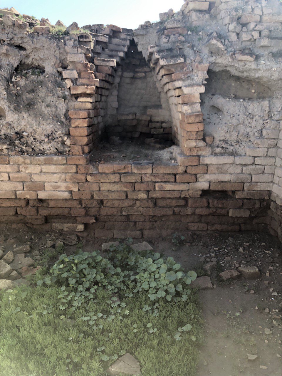
Photo Credit: Humat Dijlah ©
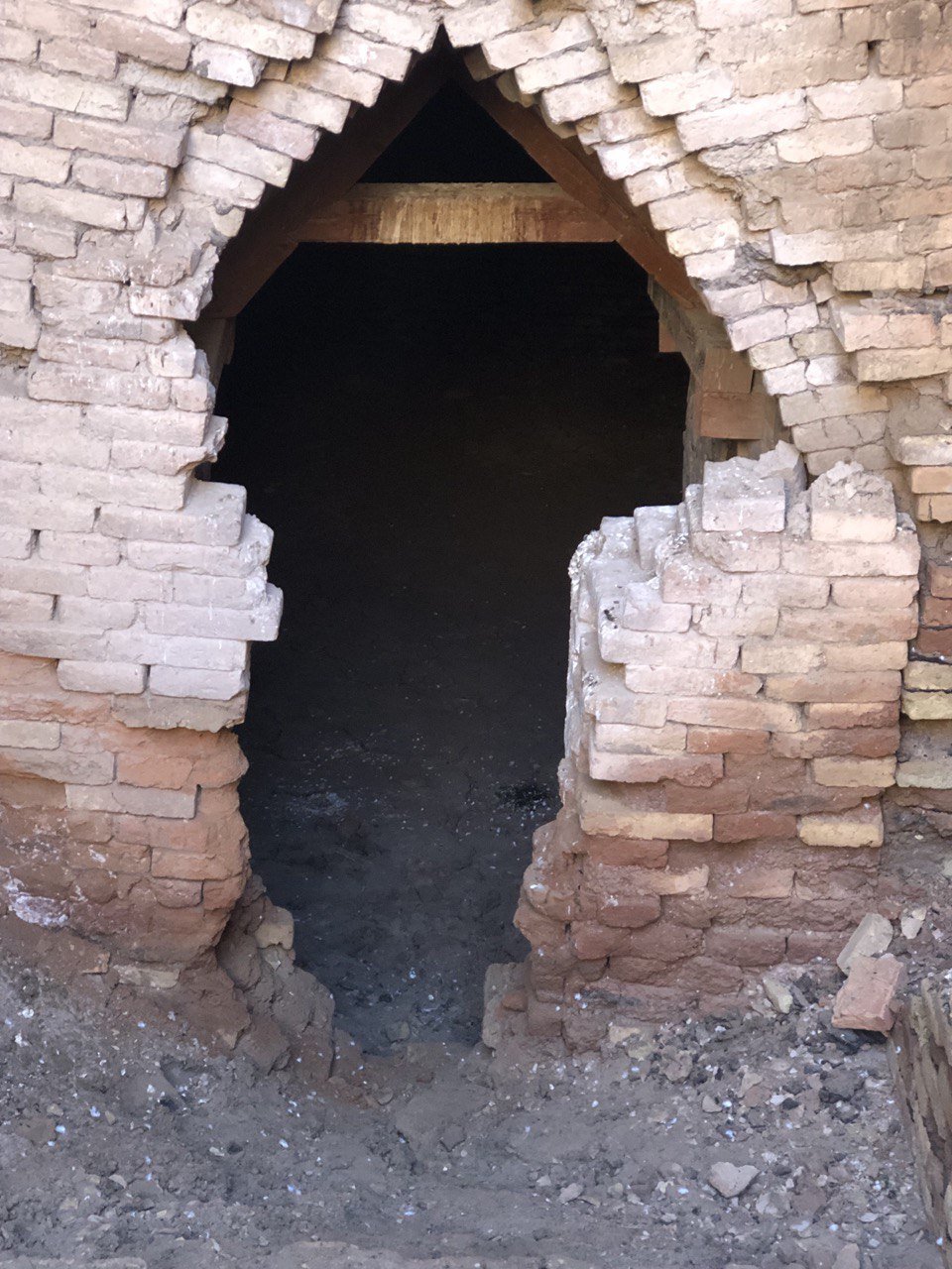
Photo Credit: Humat Dijlah ©
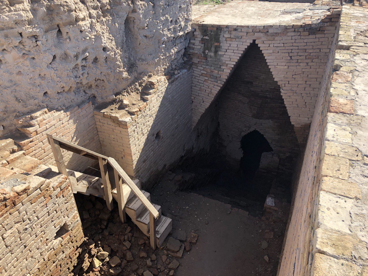
Photo Credit: Humat Dijlah ©
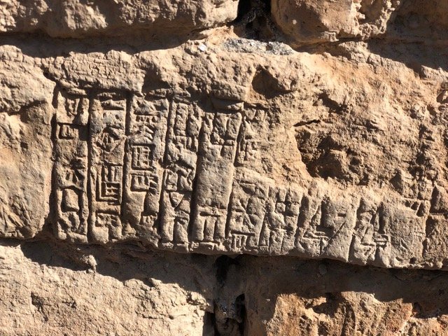
Photo Credit: Humat Dijlah ©
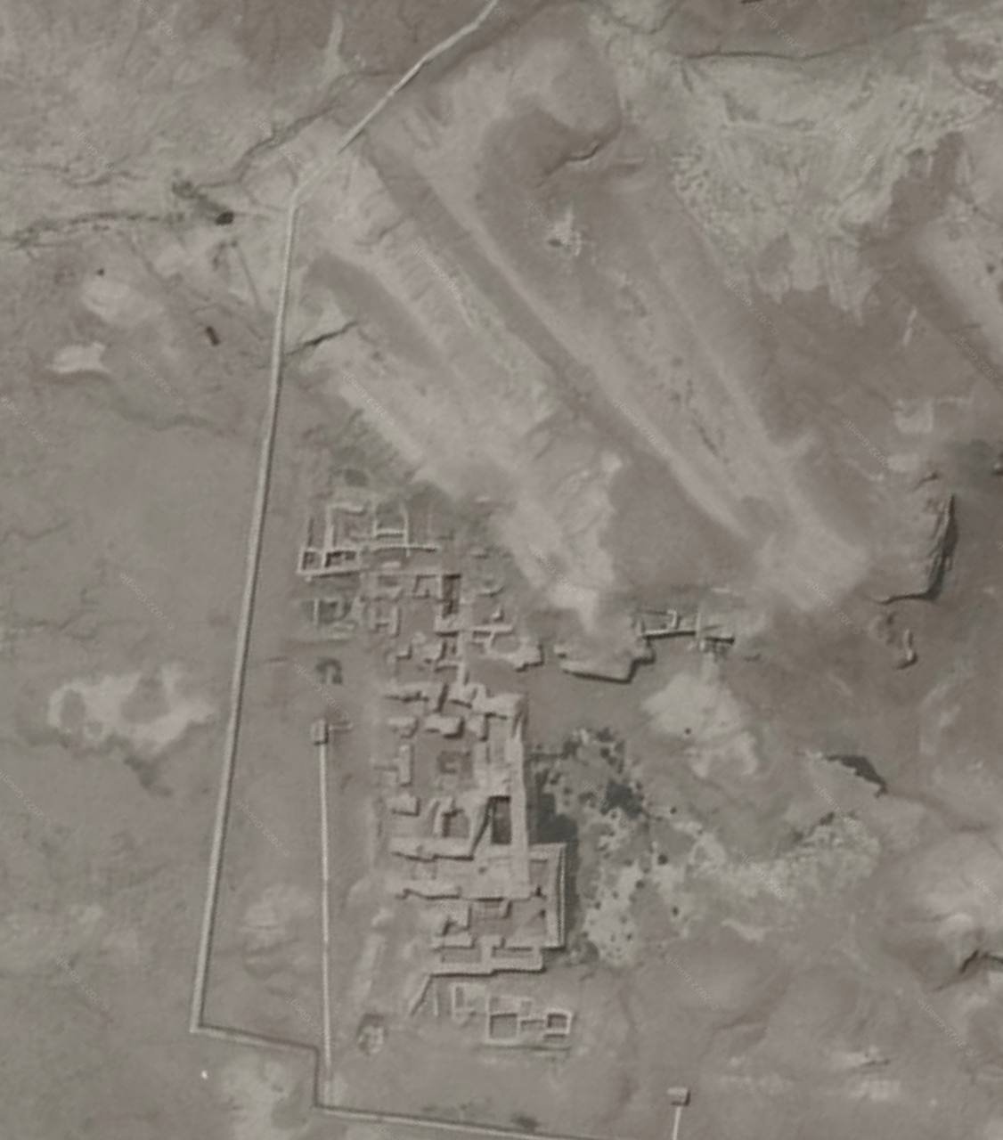
Photo Credit: Humat Dijlah ©
Ur, IRAQ
Ur was an important Sumerian city-state in ancient Mesopotamia, located at the site of modern "Tell el-Muqayyar" in south Iraq's Dhi Qar Governorate. Although Ur was once a coastal city near the mouth of the Euphrates on the Persian Gulf, the coastline has shifted and the city is now well inland, on the south bank of the Euphrates, 16 kilometres (9.9 miles) from Nasiriyah in modern-day Iraq. The city dates from the Ubaid period circa 3800 BC, and is recorded in written history as a city-state from the 26th century BC, its first recorded king being Mesannepada.
The city's patron deity was Nanna (in Akkadian, Sin), the Sumerian and Akkadian moon god, and the name of the city is in origin derived from the god's name, UNUGKI, literally "the abode (UNUG) of Nanna".The site is marked by the partially restored ruins of the Ziggurat of Ur, which contained the shrine of Nanna, excavated in the 1930s. The temple was built in the 21st century BC, during the reign of Ur-Nammu and was reconstructed in the 6th century BC by Nabonidus, the last king of Babylon. The ruins cover an area of 1,200 metres (3,900 ft) northwest to southeast by 800 metres (2,600 ft) northeast to southwest and rise up to about 20 metres (66 ft) above the present plain level.
Though some of the areas that were cleared during modern excavations have sanded over again, the Great Ziggurat is fully cleared and stands as the best-preserved and most visible landmark at the site. The famous Royal tombs, also called the Neo-Sumerian Mausolea, located about 250 metres (820 ft) south-east of the Great Ziggurat in the corner of the wall that surrounds the city, are nearly totally cleared. Parts of the tomb area appear to be in need of structural consolidation or stabilization.
There are cuneiform (Sumerian writing) on many walls, some entirely covered in script stamped into the mud-bricks. The text is sometimes difficult to read, but it covers most surfaces. Modern graffiti has also found its way to the graves, usually in the form of names made with coloured pens (sometimes they are carved). The Great Ziggurat itself has far more graffiti, mostly lightly carved into the bricks. The graves are completely empty. A small number of the tombs are accessible. Most of them have been cordoned off. The whole site is covered with pottery debris, to the extent that it is virtually impossible to set foot anywhere without stepping on some. Some have colours and paintings on them. Some of the "mountains" of broken pottery are debris that has been removed from excavations. Pottery debris and human remains form many of the walls of the royal tombs area. In May 2009, the United States Army returned the Ur site to the Iraqi authorities, who hope to develop it as a tourist destination.
Preservation
Since 2009, the non-profit organization Global Heritage Fund (GHF) has been working to protect and preserve Ur against the problems of erosion, neglect, inappropriate restoration, war and conflict. GHF's stated goal for the project is to create an informed and scientifically grounded Master Plan to guide the long-term conservation and management of the site, and to serve as a model for the stewardship of other sites.
Since 2013, the institution for Development Cooperation of the Italian Ministry of Foreign Affairs DGCS and the SBAH, the State Board of Antiquities and Heritage of the Iraqi Ministry of Tourism and Antiquities, have started a cooperation project for "The Conservation and Maintenance of Archaeological site of UR". In the framework of this cooperation agreement, the executive plan, with detailed drawings, is in progress for the maintenance of the Dublamah Temple (design concluded, works starting), the Royal Tombs—Mausolea 3rd Dynasty (in progress)—and the Ziqqurat (in progress). The first updated survey in 2013 has produced a new aerial map derived by the flight of a UAV (unmanned aerial vehicle) operated in March 2014. This is the first high-resolution map, derived from more than 100 aerial photograms, with an accuracy of 20 cm or less. A preview of the ORTHO-PHOTOMAP of Archaeological Site of UR is available online.
Excavations
Since 2012, a joint team of Italian and Iraqi archaeologists led by Franco D'Agostino have been excavating at Tal Abu Tbeirah, located 15 kilometers east of Ur and 7 kilometers south of Nasariyah. The site, about 45 hectares in area, appears to have been a harbor and trading center associated with Ur in the later half of the 3rd Millennium BC.
©Wikipedia
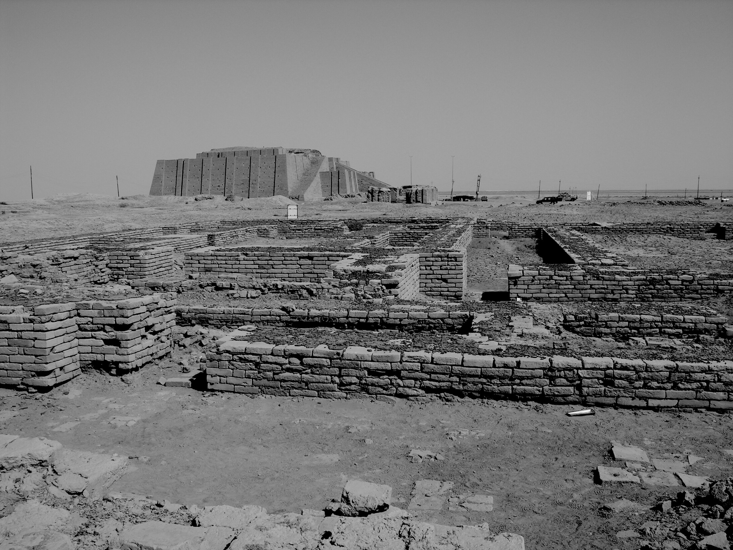
Photo credit: M.Lubinski